Last night, Pearl asked to look at our house on my phone. She clicked on the map icon, and viewed a satellite pic of our property.
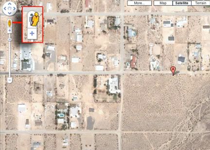
Satellite view of our street.
Pearl noticed a little man on top of the the satellite image. Pushing it, to our surprise, brought the image to street level. We were looking at our house!

We could move the image up and down our street, and view a 360 image of our neighborhood! It was a bit unnerving, but I suppose these images have a purpose.
You can try it yourself by visiting maps.google.com. Type in an address, a business, or a town. Zoom in to easily view the streets on the map, then drag the little man to the street you want to view.
Here is our local community college as seen on Google Maps.

Here is a house I lived in during my high school years.

What’s your opinion of Google’s street-level maps? Informative or creepy?